
Beijing (Agencies): Pakistan on Monday launched two indigenously manufactured satellites into orbit using a Chinese launch vehicle.
The satellites were launched on board a Chinese Long March (LM-2C) launch vehicle from Jiuquan Satellite Center, China.
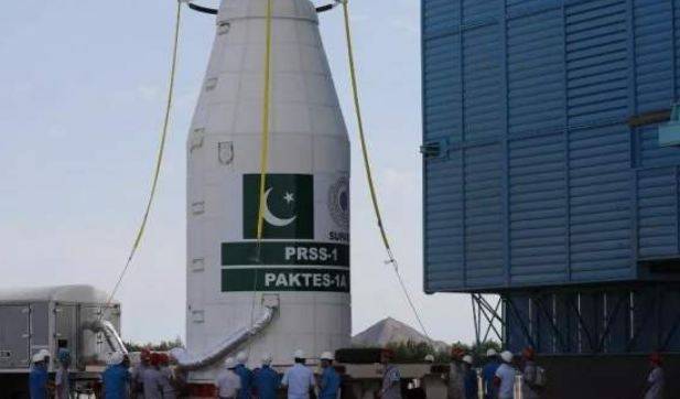
The 1,200 kg satellite PRSS-1 will operate at an altitude of 640 km. The satellite will enable Pakistan to meet its imagery requirements in the areas of land mapping, agriculture classification and assessment, urban and rural planning, environmental monitoring, natural disaster management and water resource management for the socio-economic development of the country.
With the launch of this satellite, Pakistan has become one of the few countries to have its own remote sensing satellite in the orbit.
Another flagship satellite, Pakistan Technology Evaluation Satellite-1A (PakTES-1A) indigenously designed and developed by SUPARCO’s engineers, has also been co-launched with PRSS-1 by the same launch vehicle.
a3d58e9b1d9ef0e4f287db1b3fa43e2f
PakTES-1A is a 285 kg satellite equipped with an optical payload commensurate with national needs. It has a design life of three years and will operate at an altitude of 610 km.
The successful implementation of PRSS-1 and PakTES-1A projects has further strengthened the space cooperation between Pakistan and China for future collaborations.
The President and Prime Minister of the Islamic Republic of Pakistan have congratulated the nation on this historic event and appreciated SUPARCO’s scientists and engineers for their technical excellence and untiring efforts.
The China Academy of Launch Vehicle Technology (CALVT) and Pakistan’s Space and Upper Atmosphere Research Commission (SUPARCO) have jointly made the satellites.