
Canada (Web Desk): It took thousands of years of climate change to dry up any river but recently a Canadian river vanished within a few months due to extreme change in climate.
In the summer of 2016, the global warming-induced retreat of Kaskawulsh Glacier — one of the largest glaciers in Canada — altered the flow of its meltwater so substantially that it killed off one river and shunted its waters over to another, an abrupt geological act known as river piracy.
A team of Canadian researchers were serendipitously on hand to document the upheaval, which likely marks a permanent change and could have substantial consequences for the ecology and surroundings of both waterways, the Guardian reported.
While river piracy, or stream capture, is known to have happened in the past because of swings in Earth’s climate, most of those examples were from thousands of years ago. This instance is the first attributed to human-caused climate change.
Rachel Headley, a glacial geologist at the University of Wisconsin-Parkside, who wasn’t involved with the work said, “This is one of the first examples of this that I’ve actually read about that’s been captured while it’s been happening.”
While much of the focus of studies on melting glaciers has been focused on their contributions to sea level rise, the new research, detailed Monday in the journal Nature Geoscience, shows that climate change can have unexpected impacts with potentially large consequences, the authors say.
“Beheaded” river
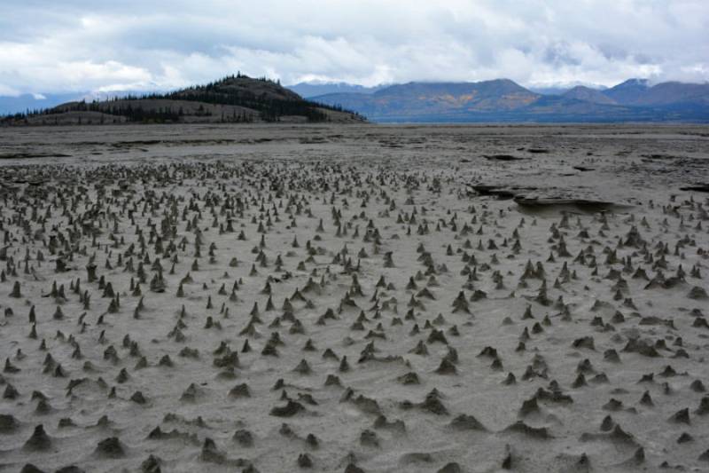
Dan Shugar, a geomorphologist at the University of Washington Tacoma, and his colleagues set out last summer to continue research they had been doing in the delta of the northward-flowing Slims River, which is fed by meltwater from Kaskawulsh. But when they arrived in the remote area of the Yukon where the glacier is situated, they heard the river was unusually low.
Even with that warning, though, “we were pretty shocked to see just how low it was,” Shugar said. Driving by it, “you could see the water level dropping day by day.”
Since the team had already invested the time and money getting to the area, they decided to dig into the mystery and see “who flipped the switch, so to speak,” he said.
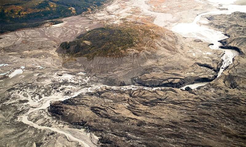
The team went to the toe of the glacier, where the ice ends, and used a drone and GPS equipment to map the topography of the area. Combining that with streamflow data and decades of satellite images, they were able to piece together “the story, the timeline of what happened here,” Shugar said.
That story begins about 300 years ago during the Little Ice Age, when colder global temperatures caused glaciers around the world to advance. Prior to that period, Kaskawulsh Glacier’s meltwater had all flowed to the south, along what is now the Alsek River, because it was steeper and water will flow along the easiest path to the sea.
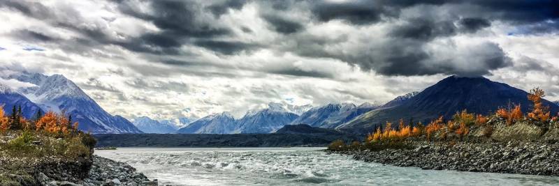
But as the glacier advanced, its tip “was like a giant foot that stood in the valley blocking that southerly route,” Shugar said, causing its meltwater to split into two flows. Some still flowed to the south and out to the Pacific Ocean, but a new northern route was created: now, the Slims River flowed into Kluane Lake and a river of the same name, which itself fed the Yukon River on its journey to the Bering Sea off the West Coast of Alaska.
Since the mid-1950s, though, Kaskawulsh has retreated some 2,150 feet and thinned considerably thanks to rising temperatures fueled by the increase of heat-trapping greenhouse gases in the Earth’s atmosphere. That long-term retreat combined with unusually warm temperatures in the spring and summer of 2016 likely caused strong melting.
The resulting meltwater cut a channel in the ice that connected the headwaters of the northward-flowing Slims to the southerly drainage and gravity took over.